DGI 2026
23 - 25 February 2026
Queen Elizabeth II Centre, London
Day 3 | 25th February 2026
8:00 am - 8:00 am
Breakfast Brainstorm - How To Overcome Interoperability Challenges To Fuse and Integrate Allied Data Streams And Deliver Trusted, Verifiable Insights Across Coalition Operations
8:00 am - 8:55 am
Welcome Networking - Gov-to-Gov and Industry Engagement
8:55 am - 9:00 am
Morning to Lunch Chair’s Opening Remarks
Interoperable GEOINT
9:00 am - 9:20 am
Government Keynote – Future of Interoperability: How Changing Mission Demands Will Drive New Requirements for Intelligence Interoperability
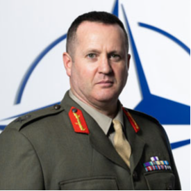
Major General Paul Lynch -
Deputy Assistant Secretary of Intelligence,
NATO HQ
- Adapt to Mission Change: How to redefine interoperability frameworks to meet dynamic, multi-domain operational requirements.
- Enable Seamless Exchange: How to ensure intelligence flows securely and efficiently across national, allied, and commercial partners.
- Standardise for Scale: How to build common data models and protocols that accelerate coalition decision-making.
- Future-Proof Architectures: How to design systems ready for modular upgrades and emerging threats in fast-evolving environments.
9:20 am - 9:40 am
Government Keynote –Leveraging Lessons Learnt from Modern Operations to Transform Intelligence Processes
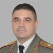
Brigadier General Danail Baev -
Director of Intelligence Directorate,
European Union Military Staff (EUMS)
- Identify Operational Gaps: How to turn recent mission insights into improvements across the intelligence lifecycle.
- Modernise Intelligence Workflows: How to redesign collection, fusion, and analysis processes for speed, precision, and adaptability.
- Enable Agile Decision-Making: How to apply battlefield lessons to accelerate command responsiveness in complex environments.
- Drive Continuous Improvement: How to institutionalise learning from real-world operations into future ISR planning and execution.
Brigadier General Danail Baev
Director of Intelligence DirectorateEuropean Union Military Staff (EUMS)
9:40 am - 10:10 am
Leadership Fireside Chat – Collaboration on Interoperable Intelligence: How Can Alliances and Nations Work Together to Share Verifiable Intelligence and Counter Disinformation and Misinformation?
Brigadier General Danail Baev -
Director of Intelligence Directorate,
European Union Military Staff (EUMS)
Major General Paul Lynch -
Deputy Assistant Secretary of Intelligence,
NATO HQ
- Strengthen Allied Trust: How to establish shared protocols that ensure secure, validated intelligence across NATO-EU partners.
- Combat Information Threats: How to verify sources and counter adversary deception through transparent, multi-source intelligence fusion.
- Build Interoperable Systems: How to align technical architectures to enable real-time data sharing without compromising sovereignty.
- Support Unified Response: How to deliver credible, shared situational awareness that drives coordinated action across allied missions.
Brigadier General Danail Baev
Director of Intelligence DirectorateEuropean Union Military Staff (EUMS)
10:10 am - 10:40 am
Voice of the Operator – Lessons Learnt from Recent Missions
10:40 am - 11:20 am
Morning Break - Gov-to-Gov and Industry Engagement
10:40 am - 11:20 am
Workshop – Maritime Intelligence Fusion: How To Integrate Satellite, AIS, And Classified Data Streams To Support Joint Maritime Operations And Real-Time Threat Identification
Advancing Maritime ISR
11:20 am - 11:40 am
Government Keynote -Operation Highmast: 5 Lessons Learnt Integrating and Connecting ISR Networks at Sea
- Unify Maritime ISR: How to connect sensors, platforms, and analysts into one seamless naval intelligence network.
- Adapt to Environment: How to overcome bandwidth, latency, and comms challenges unique to naval ISR operations.
- Accelerate Decision Loops: How to deliver faster, ship-to-shore intelligence cycles through smarter network orchestration.
- Enable Coalition Interoperability: How to integrate allied ISR feeds securely for shared maritime situational awareness and targeting.
11:40 am - 12:00 pm
Industry Keynote – Autonomous ISR: How to Deploy Autonomous, Networked ISR to Monitor and Protect Undersea Cables and Critical Infrastructure
- Secure Subsea Assets: How to detect threats and disruptions to undersea cables using persistent autonomous surveillance.
- Enable Persistent Coverage: How to deploy AI-enabled ISR platforms for 24/7 monitoring of critical maritime infrastructure.
- Integrate Multi-Domain Sensors: How to fuse acoustic, optical, and RF data for real-time subsea situational awareness.
- Automate Threat Response: How to use autonomous ISR to alert, track, and assess anomalies without human intervention.
12:00 pm - 1:00 pm
Leadership Fireside Chat – GEOINT in the Maritime Domain: How Can Partners in the Indo-Pacific Share Trusted GEOINT to Strengthen Regional Security and Strategic Stability?
Melissa Best -
Assistant Secretary Intelligence and Insights,
Australian Geospatial-Intelligence Organisation
- Build Trusted Networks: How to establish secure frameworks for GEOINT exchange across allied and regional defence partners.
- Enable Shared Awareness: How to deliver timely, trusted intelligence to support joint operations across Indo-Pacific theatres.
- Strengthen Regional Resilience: How to use GEOINT collaboration to deter coercion, monitor threats, and protect vital infrastructure.
- Promote Data Interoperability: How to align standards and systems to ensure seamless geospatial data sharing across jurisdictions.

Melissa Best
Assistant Secretary Intelligence and InsightsAustralian Geospatial-Intelligence Organisation
1:00 pm - 1:55 pm
Lunch Break - Gov-to-Gov and Industry Engagement
1:00 pm - 1:55 pm
VIP Lunch
Track A – Unlocking Innovations in Imagery from Space
1:55 pm - 2:00 pm Chair’s Opening RemarksTrack A – Unlocking Innovations in Imagery from Space
2:00 pm - 2:20 pm Government Use Case – How Space-Based ISR Breakthroughs Can Enhance Early Warning and Rapid Response in Humanitarian Missions- Detect Crises Earlier: How to use orbital sensors to identify emerging disasters before they escalate.
- Accelerate Humanitarian Response: How to deliver near-real-time imagery for faster mobilisation and aid deployment.
- Monitor Dynamic Environments: How to track evolving threats like floods, wildfires, and displacement zones with persistent space coverage.
- Enable Coordinated Relief: How to share trusted ISR with partners for unified, data-driven humanitarian decision-making.
Track A – Unlocking Innovations in Imagery from Space
2:20 pm - 2:40 pm Industry Presentation – How Can Satellites Be Adapted to Deliver More Useful ISR Capabilities For Modern Humanitarian Response Missions?- Accelerate Platform Design: How to shorten development cycles for satellites tailored to humanitarian intelligence needs.
- Adapt to Mission Shifts: How to reconfigure ISR payloads quickly to support evolving crisis response requirements.
- Enhance Rapid Mapping: How to deliver high-resolution imagery to aid situational awareness in disaster-affected regions.
- Support Agile Deployment: How to launch scalable, responsive ISR platforms for timely support in global humanitarian emergencies.
Track A – Unlocking Innovations in Imagery from Space
2:40 pm - 3:10 pm Leadership Fireside Chat – How Can You Combine AI, ML and Space-based Data to Improve Outcomes in Humanitarian and Disaster Missions?- Accelerate Crisis Detection: How to use satellite imagery and AI to identify emerging disasters before escalation.
- Guide Aid Delivery: How to combine ML and geospatial data to prioritise routes, populations, and supply chains.
- Enhance Situational Awareness: How to fuse real-time space data with predictive models for informed response coordination.
- Support Multinational Teams: How to share AI-enhanced insights across agencies for faster, more unified humanitarian operations.
Track B – Fusing Interoperable Geospatial Data
1:55 pm - 2:00 pm Chair’s Opening Remarks Brigadier General Friedrich Teichmann - Commander for: CIS. IT, EW, Geo and Space Services, Austrian Armed Forces
Brigadier General Friedrich Teichmann
Commander for: CIS. IT, EW, Geo and Space ServicesAustrian Armed Forces

Track B – Fusing Interoperable Geospatial Data
2:00 pm - 2:20 pm Alliance Insights – How NCIA Is Advancing Interoperability to Strengthen Intelligence Sharing and Mission Effectiveness Across the NATO Alliance Richard Laing - Senior Scientist, Joint Intelligence, Surveillance and Reconnaissance, NATO NCIA- Standardise NATO Systems: How to align technical architectures and protocols for seamless multi-national intelligence exchange.
- Enable Trusted Sharing: How to ensure secure, verifiable data flows across NATO partners in complex operational environments.
- Accelerate Joint Readiness: How to improve interoperability to support faster coordination and decision-making in coalition missions.
- Future-Proof Infrastructure: How to design interoperable frameworks that adapt to evolving technologies and mission demands.

Richard Laing
Senior Scientist, Joint Intelligence, Surveillance and ReconnaissanceNATO NCIA
Track B – Fusing Interoperable Geospatial Data
2:20 pm - 2:40 pm Industry Presentation – Implementing Interoperable OSINT Platforms to Ensure Operational Confidence in Multi-Agency Intelligence Sharing- Standardise OSINT Workflows: How to align data formats and structures for seamless cross-agency information exchange.
- Validate Open Sources: How to ensure OSINT reliability through verification, provenance tracking, and automated confidence scoring.
- Support Joint Operations: How to share open-source intelligence securely to enable faster, coordinated multi-agency responses.
- Strengthen Interoperability Foundations: How to build modular, scalable OSINT platforms that integrate easily into existing intelligence ecosystems.
Track B – Fusing Interoperable Geospatial Data
2:40 pm - 3:10 pm Leadership Fireside Chat – How Can Defence Collaborate with Civilian Organisations to Improve OSINT Sharing During Crisis Response Operations? Colonel Samuel Gelzer - Head of Imagery and Intelligence Centre, Swiss Armed Forces- Bridge Civil-Military Gaps: How to align protocols and priorities for secure, timely open-source intelligence sharing.
- Enable Trusted Exchange: How to validate and verify OSINT collaboratively across agencies for operational confidence.
- Accelerate Crisis Coordination: How to use shared OSINT platforms to improve speed and clarity in disaster response missions.
- Enhance Situational Awareness: How to integrate diverse civilian OSINT sources to expand operational understanding in complex environments.
Colonel Samuel Gelzer
Head of Imagery and Intelligence CentreSwiss Armed Forces
Track C – Hybrid Maritime ISR in Support of Protecting CNI
1:55 pm - 2:00 pm Chair’s Opening RemarksTrack C – Hybrid Maritime ISR in Support of Protecting CNI
2:00 pm - 2:20 pm Government Use Case – Lessons Learned from Combining Sensor Data and Analytics to Detect and Prevent Threats to Undersea Cables Lt Colonel Eike Hansen - Maritime Intelligence Lead, Bundeswehr- Fuse Multi-Sensor Inputs: How to combine acoustic, satellite, and RF data for comprehensive subsea threat detection.
- Enable Early Warning: How to identify unusual activity near cable routes before it escalates into a disruption.
- Support Rapid Response: How to deliver timely intelligence to maritime forces protecting critical subsea infrastructure.
- Refine Detection Models: How to use real-world insights to improve analytics accuracy and threat classification at scale.
Lt Colonel Eike Hansen
Maritime Intelligence LeadBundeswehr
Track C – Hybrid Maritime ISR in Support of Protecting CNI
2:20 pm - 2:40 pm Industry Presentation – How to Use Space Sensors, AI, and Data Fusion to Transform Maritime Domain Awareness and Threat Detection- Enhance Wide-Area Tracking: How to leverage satellite constellations for persistent surveillance across open seas and chokepoints.
- Detect Anomalous Behaviour: How to use AI to identify suspicious vessel activity and maritime domain threats in real time.
- Fuse Multi-Source Data: How to integrate AIS, EO, SAR, and RF inputs for a complete maritime intelligence picture.
- Secure Critical Routes: How to monitor and protect strategic maritime corridors against disruption, sabotage, and grey zone activity.
Track C – Hybrid Maritime ISR in Support of Protecting CNI
2:40 pm - 3:10 pm Leadership Fireside Chat – How Can You Leverage Innovation in Seafloor Mapping to Detect Threats to Maritime Critical National Infrastructure Earlier and More Precisely? Lt Colonel Eike Hansen - Maritime Intelligence Lead, Bundeswehr Jeremy Churcher - Head of Defence, United Kingdom Hydrographic Office Wayne Elliott - Head of Defence, UK Met Office Dr. Marlene Meyer - National Geospatial Officer, Joint GEOMETOC Support Centre, Danish Defence- Map the Unknown: How to use advanced bathymetry to uncover vulnerabilities around critical subsea infrastructure.
- Detect Threats Sooner: How to identify unusual activity near cables and pipelines using high-resolution mapping data.
- Improve Monitoring Precision: How to integrate seafloor data with ISR to track threats with greater confidence and accuracy.
- Enable Rapid Response: How to support faster intervention by delivering detailed subsea awareness to maritime security teams.
Lt Colonel Eike Hansen
Maritime Intelligence LeadBundeswehr


3:10 pm - 3:40 pm
Afternoon Break - Gov-to-Gov and Industry Engagement
Mapping the Arctic
3:40 pm - 4:10 pm
Leadership Fireside Chat – Arctic Intelligence Sharing: What Do Mission Partners in the Arctic Need from Geospatial Intelligence to Deter Threats to National Sovereignty, Regional Security and Global Stability?
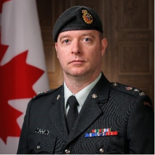
Colonel Al Mannard -
Assistant Chief of Staff Ops, Central Forces Intelligence Command,
Canadian Armed Forces
Dr. Marlene Meyer -
National Geospatial Officer,
Joint GEOMETOC Support Centre, Danish Defence
- Enhance Domain Awareness: How to provide persistent GEOINT coverage in remote, contested Arctic operating environments.
- Support Sovereignty Protection: How to monitor activity and assert presence across national territories and exclusive economic zones.
- Enable Allied Coordination: How to share trusted Arctic intelligence to support joint planning and rapid response operations.
- Track Emerging Threats: How to detect military build-up, illegal activity, and environmental change with high-resolution, multi-source data.
Colonel Al Mannard
Assistant Chief of Staff Ops, Central Forces Intelligence CommandCanadian Armed Forces
Future of GEOINT Professionalisation
4:10 pm - 4:30 pm
Government Keynote – Workforce Transformation: How to Transform the GEOINT Workforce to Support National Defence and Security in a Volatile World
- Upskill for Tomorrow: How to build GEOINT talent with digital, analytical, and mission-focused expertise.
- Redefine Professional Pathways: How to create structured career models that attract and retain top geospatial intelligence professionals.
- Align with National Vision: How to ensure the GEOINT workforce supports evolving strategic and operational defence priorities.
- Adapt to Disruption: How to embed agility, innovation, and resilience into your intelligence workforce development strategy.
4:30 pm - 5:00 pm
Leadership Discussion - From Compass to Cloud to Claude: Reimagining Collaborative Geospatial Intelligence Education.
Prof Todd Bacastow -
Professor of Practice for Geospatial Intelligence,
Penn State University
- Modernise GEOINT Learning: How to update curricula with cloud-native tools, AI, and immersive geospatial technologies.
- Foster Cross-Sector Collaboration: How to align government, academia, and industry around shared educational goals and innovation pipelines.
- Upskill for AI: How to prepare analysts and operators to harness generative AI and automation responsibly.
- Promote Lifelong Learning: How to embed continuous education models that evolve with mission demands and technological change.