DGI 2026
23 - 25 February 2026
Queen Elizabeth II Centre, London
Day 1 | 23rd February 2026
7:45 am - 8:35 am
Registration & Gov-to-Gov and Industry Engagement
8:35 am - 8:40 am
Organiser’s Welcome
8:40 am - 8:45 am
Morning to Lunch Chair’s Opening Remarks
Evolution of Defence Intelligence
8:45 am - 9:00 am
UK Ministerial Keynote – Sovereign Defence Intelligence: How will the UK Lead on AI, Alliances, Partnerships and Space to Strengthen National Security
- Lead with AI Mastery: How to integrate AI into defence to maintain strategic edge.
- Forge Global Partnerships: How to deepen allied trust to counter shifting geopolitical threats with unified strength.
- Secure Space Sovereignty: How to advance UK space assets to dominate ISR and protect critical infrastructure.
- Champion Strategic Autonomy: How to reduce foreign tech dependency to safeguard mission assurance and national interests.
9:00 am - 9:20 am
CDI UK Keynote – Moving Beyond Convention: Rethinking How to Deliver Defence Intelligence in a Volatile World
- Rethink Intelligence Models: How to challenge legacy frameworks to deliver faster, mission-ready defence insights.
- Adapt to Volatility: How to align intelligence methods with unpredictable global threats and shifting operational priorities.
- Accelerate Decision Advantage: How to transform data into actionable intelligence for timely, high-consequence decisions.
- Modernise with Urgency: How to integrate digital tools to outpace adversaries in dynamic conflict environments.
Future of Imagery Collection and Analysis
9:20 am - 10:00 am
In Discussion – Strategic Alignment: How are UK Defence Intelligence and UK Space Command Aligning to Deliver Sovereign Space Capability?
- Align National Priorities: How to coordinate defence and space strategies to strengthen sovereign UK capability.
- Unify Command Vision: How to synchronise leadership efforts for coherent space-based intelligence and operational delivery.
- Enable Sovereign Resilience: How to build UK-owned space assets to ensure secure, independent mission support.
- Integrate Across Domains: How to link space intelligence with multi-domain operations for enhanced warfighting effectiveness.
10:00 am - 10:20 am
Industry Keynote – Real-time Ground Truth and the Future of Space-based Intelligence
- Deliver Ground Truth: How to provide verified, real-time imagery to enable faster and more accurate decisions.
- Transform ISR Timelines: How to reduce latency from space to screen for decisive operational advantage.
- Maximise Commercial Innovation: How to harness private-sector constellations to scale persistent surveillance and tasking flexibility.
- Fuse Space Intelligence: How to combine orbital data with multi-source feeds for enriched situational awareness and targeting.
10:20 am - 10:50 am
Leadership Panel Discussion – Multi-Source Imagery: How Can You Modernise Multi-Domain Imagery Collection and Analysis to Achieve the Right Balance of Affordable, Timely, High-Quality and Trustworthy Geospatial Intelligence for the Mission Needs?
Colonel Neil Lakin -
Department Head Joint Geoint,
Cyber & Specialist Operations Command, UK MoD
Pascal Legai -
Senior Security Advisor to the Director General,
European Space Agency (ESA)
- Harness Proliferated Constellations: How to exploit pLEO networks for resilient, real-time tactical intelligence delivery.
- Enable Targeting Agility: How to shorten sensor-to-shooter timelines through integrated ISR and responsive space assets.
- Future-Proof ISR Doctrine: How to evolve national strategies to embed TacSRT into operational planning and execution.
- Secure Tactical Superiority: How to prepare infrastructure and workflows for space-based support to frontline warfighters.
Colonel Neil Lakin
Department Head Joint GeointCyber & Specialist Operations Command, UK MoD
10:50 am - 11:30 am
Morning Break - Gov-to-Gov and Industry Engagement
10:50 am - 11:30 am
Workshop – Automated Data Fusion: How to Integrate Multi-Source ISR to Scale Geospatial Intelligence and Boost Agility
- Unify ISR Inputs: How to merge EO, SAR, RF, and HUMINT data into one actionable intelligence stream.
- Boost Decision Agility: How to reduce analysis time through automation and deliver faster mission-ready geospatial insights.
- Streamline Intelligence Pipelines: How to automate data ingestion, tagging, and fusion to improve ISR responsiveness at scale.
- Reduce Analyst Burden: How to offload manual processing by using AI to handle complex multi-source correlation tasks.
Next-Gen Space-based ISR
11:30 am - 11:50 am
US Space Keynote – Sustaining Combat Ready ISR from Space
11:50 am - 12:10 pm
EU Keynote – Strengthening European Defence: How Space Policy is Driving Operational Readiness, Strategic Autonomy and Allied Cohesion Across the EU
Apostolia Karamali -
Cabinet Member, Comissioner of Defence and Space,
European Union Commission
- Advance EU Autonomy: How to leverage space policy to reduce defence reliance on external actors.
- Strengthen Strategic Readiness: How to align space capabilities with EU security priorities for faster threat response.
- Boost Allied Cohesion: How to harmonise national programmes to support collective operations and shared situational awareness.
- Secure Critical Infrastructure: How to protect European space assets from disruption in high-risk geopolitical environments.

Apostolia Karamali
Cabinet Member, Comissioner of Defence and SpaceEuropean Union Commission
12:10 pm - 12:30 pm
Industry Keynote – New Geospatial Techniques from Space Transforming Situational Awareness on Land and Sea
Rob Palm -
Senior Director International Business Development,
HawkEye360
- Elevate Mission Awareness: How to deliver precise, persistent insights for faster land and maritime decision-making.
- Exploit Orbital Innovation: How to apply next-gen sensors to uncover hidden activity across complex terrains and waters.
- Streamline Intelligence Delivery: How to reduce latency from collection to action for operational units in fast-moving environments.
- Fuse Multi-Domain Views: How to integrate space data with terrestrial feeds to support real-time operational coordination.
12:30 pm - 1:00 pm
Leadership Fireside Chat – How are National Governments Preparing Themselves for the Age of pLEO (proliferated LEO) and TacSRT (Tactical Surveillance, Reconnaissance and Targeting)?
- Harness Proliferated Constellations: How to exploit pLEO networks for resilient, real-time tactical intelligence delivery.
- Enable Targeting Agility: How to shorten sensor-to-shooter timelines through integrated ISR and responsive space assets.
- Future-Proof ISR Doctrine: How to evolve national strategies to embed TacSRT into operational planning and execution.
- Secure Tactical Superiority: How to prepare infrastructure and workflows for space-based support to frontline warfighters.
1:00 pm - 1:55 pm
Lunch Break – Gov-to-Gov and Industry Engagement
1:00 pm - 1:55 pm
VIP Lunch
Track A – Faster Data & Imagery from Space
1:55 pm - 2:00 pm Chair’s Opening RemarksTrack A – Faster Data & Imagery from Space
2:00 pm - 2:20 pm Joint Presentation – How Canada Is Integrating Commercial and Sovereign Space ISR to Strengthen Situational Awareness for Mission Commanders Col. Yannick Michaud - Director General Intelligence Enterprise (DGIE), Canadian Armed Forces- Blend Public and Private: How to combine sovereign assets with commercial constellations for expanded ISR coverage.
- Support Tactical Commanders: How to deliver timely, mission-relevant space intelligence directly to decision-makers in the field.
- Enhance National Resilience: How to build a flexible ISR architecture that ensures operational independence and continuity.
- Optimise Tasking Efficiency: How to coordinate space-based collection to meet priority intelligence requirements across domains.
Track A – Faster Data & Imagery from Space
2:20 pm - 2:40 pm Industry Presentation - Disrupting the Status Quo: Integrating Situational Foresight Robert Kerby - Head of Business Development EMEA, Planet- Redefine Mission Models: How to go beyond traditional IRM and CM to unlock smarter, scalable operations.
- Reveal Hidden Activity: How to observe the previously unobserved using persistent, multi-source surveillance and advanced analytics.
- Establish Behavioural Baselines: How to define what’s normal to enable anomaly detection and predictive mission insights.
- Scale Insight Production: How to industrialise data processing and analytics to deliver intelligence at operational hyperspeed and volume.
Track A – Faster Data & Imagery from Space
2:40 pm - 3:00 pm Industry Presentation - How High Revisit Rates and Rapid Delivery Are Enabling Responsive, Tactical Intelligence at Mission Speed John Cartwright - Head of Data Product, ICEYE- Enable Rapid Revisit: How to maintain constant surveillance with persistent SAR for dynamic, time-sensitive mission tracking.
- Accelerate Tactical Decisions: How to shorten the tasking-to-exploitation loop with near-instant SAR data delivery.
- Expand All-Weather Coverage: How to use SAR to ensure uninterrupted imaging through cloud, smoke, and darkness.
- Support Ground Operations: How to integrate persistent SAR feeds into frontline workflows for real-time battlefield awareness.
Track A – Faster Data & Imagery from Space
3:00 pm - 3:20 pm Enhancing Space Situational Awareness: How Traffic Coordination Advances Are Safeguarding Orbits and Enabling Secure Military Space Operations Janice Starzyk - Director, Office of Space Commerce- Track Orbital Hazards: How to improve detection and prediction of threats to military satellites and assets.
- Coordinate Global Efforts: How to build collaborative frameworks for real-time space traffic deconfliction and alerting.
- Protect Mission Continuity: How to ensure uninterrupted operations through responsive tracking and automated collision avoidance.
- Strengthen Domain Awareness: How to expand visibility across crowded orbits for better-informed space control decisions.
Track A – Faster Data & Imagery from Space
3:20 pm - 3:50 pm Leadership Fireside Chat – How Space Capabilities Are Evolving Across Africa to Strengthen Security, Connectivity, and Regional Resilience Dr Maram Kaire - Director General, Senegal National Space Agency Major Vernon Grier - Division Chief, S5I - International Engagements, US Space Force in Europe and Africa Dr Tidiane Ouattara - President of the African Space Council, African Space Agency (AFSA)- Expand Regional Reach: How to grow African space programmes for sovereignty, surveillance, and national development benefits.
- Strengthen Security Posture: How to apply space assets to monitor borders, prevent conflict, and enhance situational awareness.
- Support Economic Growth: How to leverage geospatial infrastructure for agriculture, climate resilience, and infrastructure planning.
- Foster International Collaboration: How to build cross-border partnerships to accelerate space innovation and shared operational capability.
Major Vernon Grier
Division Chief, S5I - International EngagementsUS Space Force in Europe and Africa
Track B – Next Gen AI, ML and Processing
1:55 pm - 2:00 pm Chair’s Opening Remarks Associate Professor M.Sc. Mayur Gosai - Director, iRES; Co Director, Geospatial Science & Space Center, National Intelligence University
Associate Professor M.Sc. Mayur Gosai
Director, iRES; Co Director, Geospatial Science & Space CenterNational Intelligence University

Track B – Next Gen AI, ML and Processing
2:00 pm - 2:20 pm Government Use Case – How Can You Leverage AI to Collect High Quality Geospatial Data, Analytics and Imagery from All Domains to Create the Fullest Operational Picture?Track B – Next Gen AI, ML and Processing
2:20 pm - 2:40 pm Industry Presentation - Dark Fleet Detection and Monitoring enabled through Space-Based technology John Bowers - Head of New Business Geointelligence, MDA Space- Ensuring safety and security of the ocean and ocean-going vessels is critical
- The so called “dark fleet” or “shadow fleet” are responsible for evading compliance, safety regulations, and contravening sovereignty.
- This presentation will discuss how the application of space-SAR and other sensor data combined with near-realtime CONOPS and cross-cueing can provide significant intelligence input to authorities to manage their maritime domain.
Track B – Next Gen AI, ML and Processing
2:40 pm - 3:00 pm Industry Presentation – Cheaper, Fully Controlled AI & GEOINT for Mission Planning Chuck Dostal - Senior Director, Solutions Engineering, Blackshark.ai- Faster – Deploy AI-powered geospatial intelligence in days, not months, with live inference and rapid model development.
- Cheaper – Lower operational costs and increase analyst efficiency by up to 16x by eliminating the need to outsource model development or hire consultants and developers. With HUNTR, the subject matter experts you already have can rapidly build and deploy models themselves.
- More Adaptable – Works with any visual data source, including aerial imagery, offnadir satellite, and SAR, with no-code tools to tailor AI models for mission-specific needs.
- Fully Controlled – Maintain complete ownership over AI training, deployment, and outputs to ensure security, transparency, and compliance.
Track B – Next Gen AI, ML and Processing
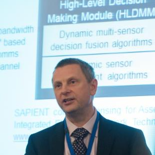
2:00 pm - 2:20 pm R&D Presentation – Sapient: The Future of UK Autonomous Sensor Network Fusion Architecture and AI Paul Thomas - Fellow, Defence Science and Technology Laboratory (Dstl)- Unify Sensor Networks: How to connect and coordinate autonomous systems for seamless multi-domain data collection.
- Automate Target Detection: How to use AI within Sapient to rapidly identify and prioritise mission-critical threats.
- Optimise Fusion Architecture: How to structure real-time data flows for low-latency, decision-grade intelligence delivery.
- Enhance Operational Agility: How to empower frontline teams with adaptive sensing that responds to evolving tactical conditions.
Track B – Next Gen AI, ML and Processing
3:20 pm - 3:50 pm Leadership Fireside Chat – How Can We Build Trust in AI for ISR for and from Space to Realise its Full Potential? Mihaela Sorostinean - GIS Project Manager, Geospatial Section, NATO HQ Dave Gauthier - Chief Strategy Officer, National Oceanic and Atmospheric Administration- Ensure Transparent Algorithms: How to validate AI models to deliver consistent, explainable ISR outputs at scale.
- Mitigate Bias Risks: How to detect and manage bias in AI to protect decision integrity.
- Strengthen Human Oversight: How to balance automation with analyst control for trustworthy, mission-ready intelligence.
- Prove Operational Value: How to demonstrate AI effectiveness in live ISR missions to drive adoption and confidence.
Mihaela Sorostinean
GIS Project Manager, Geospatial SectionNATO HQ
Track C – Integrating Multi-Domain ISR Data
1:55 pm - 2:00 pm Chair’s Opening Remarks Dave Gauthier - Chief Strategy Officer, National Oceanic and Atmospheric AdministrationTrack C – Integrating Multi-Domain ISR Data
2:00 pm - 2:20 pm NATO Presentation – Alliance Update: How NCIA Is Advancing Space Capabilities to Strengthen Collective Defence and Decision Superiority Laryssa Patten - Head, Space Technology Adoption and Resilience, NATO- Expand Allied Capability: How to develop shared space infrastructure supporting NATO operations across contested and congested domains.
- Enable Data Interoperability: How to ensure seamless integration of space-derived intelligence across national and allied systems.
- Support Mission Resilience: How to protect and sustain NATO space assets amid increasing threats and operational demands.
- Accelerate Space Integration: How to embed space support into NATO C4ISR frameworks for real-time, multi-domain coordination.
Track C – Integrating Multi-Domain ISR Data
2:20 pm - 2:40 pm Government Use Case - How to Apply AI and Advanced Analytics to Extract Actionable Insight from Complex Geospatial Datasets in Real TimeTrack C – Integrating Multi-Domain ISR Data
2:40 pm - 3:00 pm Industry Presentation – How to Build Multi-Domain Collection Strategies that Reveal Adversary Intent and Enable Pre-Emptive Operational Planning- Anticipate Adversary Moves: How to detect intent early through synchronised, multi-domain sensor tasking and monitoring.
- Enable Strategic Foresight: How to fuse diverse intelligence inputs to support predictive threat modelling and planning.
- Drive Proactive Operations: How to use real-time collection to shape decisions before adversaries take decisive action.
- Synchronise ISR Assets: How to coordinate platforms across domains to close information gaps and improve decision advantage.
Track C – Integrating Multi-Domain ISR Data
3:00 pm - 3:20 pm Government Use Case – What Can You Automate During Multi-Domain Collection and Integration Without Reducing the Quality of Geospatial Intelligence?- Streamline Collection Workflows: How to automate data capture across domains while preserving fidelity and accuracy.
- Reduce Analyst Burden: How to delegate repetitive processing tasks to AI without losing mission-critical detail.
- Maintain Quality Control: How to embed validation checks into automated pipelines for trusted geospatial intelligence outputs.
- Optimise Integration Speed: How to accelerate multi-source fusion while upholding spatial and temporal coherence standards.
Track C – Integrating Multi-Domain ISR Data
3:20 pm - 3:50 pm Leadership Fireside Chat – How Can Driving the Adoption of Standards and Interoperability in Space Reduce the Cost of Imagery Acquisition and Exploitation in the Long Term? Iris Raith - GIS OSINT Specialist, Geo & Space Services Section, NATO- Lower Integration Costs: How to standardise formats and protocols to simplify multi-source imagery ingestion and processing.
- Accelerate Imagery Access: How to enable seamless cross-platform sharing through interoperable space data architectures.
- Reduce Duplication Waste: How to coordinate collection and tasking across partners to avoid redundant imagery capture.
- Boost Analytical Efficiency: How to streamline tool compatibility and workflows for faster, more affordable insight generation.
3:50 pm - 4:20 pm
Afternoon Break - Gov-to-Gov and Industry Engagement
Innovation in ISR from Space
4:20 pm - 4:40 pm
NATO Keynote – How ISR Data Access, Fusion, and Analytics Are Strengthening Decision Advantage Across the Alliance
Matt Roper -
Service Line Chief, Intelligence Surveillance and Reconnaissance,
NATO NCIA
- Enhance Allied Access: How to deliver timely, secure ISR data across NATO for shared operational awareness.
- Accelerate Data Fusion: How to combine multi-source inputs into a unified intelligence picture for joint mission planning.
- Exploit Advanced Analytics: How to apply AI and ML to detect threats faster and prioritise operational response.
- Strengthen Interoperability: How to align ISR frameworks and standards to support seamless collaboration across NATO forces.
4:40 pm - 5:00 pm
Industry Keynote – Collection, Data, and Object Orchestration to Enable Decision Support at the Speed of Relevance
Keith Barber -
Director of Strategy and Engagements,
Bae Systems
- Orchestrate collection in a predictable manner with tools that enable rapid data access and superior feasibility insights
- Integrate ISR data with analytic tools, leveraging MOVINT and SOM databases for deeper operational understanding
- Visualize, manage, and track object custody and precision metrics aligned to roles and mission needs
- Effectively manage increasing data volume to drive timely and informed outcomes
5:00 pm - 5:30 pm
Leadership Fireside Chat – How Can Governments, Commercial Partners and Academia Collaborate to Accelerate Innovation in ISR?
Leslie Babich -
Director,
SOFWERX
Takayuki Odawara -
Executive Officer, General Manager of Business Department,
Synspective
Luca Del Monte -
Head, Commercialisation Department,
European Space Agency
5:30 pm - 6:00 pm
Dragon’s Den – Revealing 3 Innovative Start-Ups Disrupting Collection of Data and Imagery from Space to Help You Transform Your Geospatial Intelligence
Richard Laing -
Senior Scientist, Joint Intelligence, Surveillance and Reconnaissance,
NATO NCIA
Luca Del Monte -
Head, Commercialisation Department,
European Space Agency
Alexander Holt -
Managing Director, Space Enterprise,
Seraphim
- Spot Emerging Disruptors: How to identify early-stage innovators changing the way geospatial data is collected from orbit.
- Transform Imagery Access: How to adopt agile commercial solutions for faster, cheaper satellite data and analytics delivery.
- Unlock Competitive Advantage: How to integrate breakthrough technologies into your ISR stack for tactical and strategic gain.
- Accelerate Innovation Cycles: How to partner with start-ups to test and deploy novel space capabilities at speed.

Richard Laing
Senior Scientist, Joint Intelligence, Surveillance and ReconnaissanceNATO NCIA
Luca Del Monte
Head, Commercialisation DepartmentEuropean Space Agency


