DGI 2026
23 - 25 February 2026
Queen Elizabeth II Centre, London
Day 2 | 24th February 2026
8:00 am - 8:00 am
Breakfast Brainstorm - Workforce 2030: GEOINT, New Missions, Roles, and Technologies
Prof Todd Bacastow -
Professor of Practice for Geospatial Intelligence,
Penn State University
8:00 am - 8:40 am
Welcome Networking - Gov-to-Gov and Industry Engagement
8:40 am - 8:45 am
Organiser’s Welcome
8:45 am - 9:00 am
Morning to Lunch Chair’s Opening Remarks
AI-Enabled GEOINT
9:00 am - 9:20 am
In Discussion with: AI Driven Geospatial Intelligence: How AI and Machine Learning Will Revolutionise Geospatial Intelligence for Faster, Smarter Future Mission Success
- Automate Intelligence Cycles: How to use AI to accelerate tasking, collection, processing, and dissemination of geospatial data.
- Detect Threats Early: How to apply machine learning to identify hidden patterns and emerging adversary behaviour in real time.
- Fuse Multi-Source Inputs: How to integrate imagery, terrain, and sensor data using AI for enriched situational awareness.
- Empower Decision Superiority: How to deliver AI-curated, analyst-ready insights to support rapid, high-stakes operational planning.
9:20 am - 9:50 am
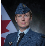
Leadership Fireside Chat - How Can You Integrate AI into Geospatial Workflows Without Losing Analyst Insight, Oversight, or Operational Control?
Lisa Baspaly-Hays -
Commander,
Canadian Forces Intelligence Group
- Balance Human-AI Teaming: How to combine automation with analyst judgment for trusted, mission-ready geospatial intelligence.
- Streamline Complex Analysis: How to apply AI to multi-domain data for faster insight without compromising quality.
- Retain Analyst Oversight: How to ensure transparency and explainability in AI outputs to support confident decision-making.
- Enhance Operational Impact: How to free analysts from routine tasks and focus expertise where it matters most.
Fusing GEOINT
9:50 am - 10:10 am
Government Keynote – Software Defined Defence – A New Paradigm to Enable Multi Domain Operations
Lt General Michael Vetter -
Chief Information Officer,
Bundeswehr
- Strengthen Information Access: How to deliver consistent, high-quality geospatial data across all operational levels and environments.
- Protect Mission Connectivity: How to defend geospatial networks and data pipelines from disruption, degradation, or compromise.
- Unify Enterprise Systems: How to ensure seamless data sharing across commands, coalitions, and domains for operational coherence.
- Drive Informed Action: How to empower commanders with reliable geospatial intelligence for faster, more connected decision-making.
10:10 am - 10:50 am
Leadership Panel Discussion – Foundation Data Fusion: How Rethinking Foundation Data Fusion Can Enrich Geospatial Intelligence and Deliver Greater Operational Advantage
- Break Down Silos: How to integrate foundational datasets to build a richer, multi-dimensional intelligence picture.
- Enrich Core Layers: How to fuse terrain, infrastructure, and environment data to support dynamic mission planning.
- Accelerate Data Utility: How to streamline foundation data workflows for faster exploitation by analysts and operators.
- Support Mission Context: How to combine base data with ISR feeds to enhance targeting, navigation, and situational awareness.
10:50 am - 11:30 am
Morning Break - Gov-to-Gov and Industry Engagement
10:50 am - 11:30 am
Workshop – Data-Centric Interoperability: How to Improve Data Literacy, Centricity, and Standards to Enable Interoperable, Mission-Ready Intelligence Across Your Organisation
- Raise Data Literacy: How to upskill teams for confident, consistent use of mission-critical geospatial information.
- Embed Data Centricity: How to restructure workflows around data as a shared, strategic asset—not a by-product.
- Standardise for Scale: How to adopt common formats and vocabularies that enable seamless system and partner interoperability.
- Break Organisational Barriers: How to improve cross-departmental collaboration through unified data governance and clear accountability.
Harnessing Open Source GEOINT
11:30 am - 11:50 am
Government Keynote – Data-Centric Intelligence: How NCGI Is Evolving Toward Data- and AI-Centric Intelligence to Accelerate Decisions and Empower Analysts
- Modernise Intelligence Architecture: How to shift NCGI systems toward data-first design for scalable, responsive decision support.
- Automate Analyst Workflows: How to use AI to streamline routine tasks and focus human effort on interpretation.
- Accelerate Mission Insight: How to generate faster, smarter intelligence by integrating structured data and analytics at the core.
- Strengthen Operational Tempo: How to reduce lag in analysis and enable real-time decision-making at every echelon.
11:50 am - 12:10 pm
Industry Keynote Title TBC
12:10 pm - 12:30 pm
Industry Keynote Title TBC
12:30 pm - 1:00 pm
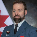
Leadership Fireside Chat – Leveraging Open Source Intelligence: How Can You Integrate Open-Source Intelligence to Make Geospatial Data and Insights More Actionable and Impactful?
Lt Colonel T J Kelley -
Commanding Officer, Mapping and Charting Establishment,
Canadian Armed Forces
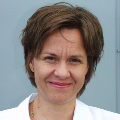
Ingrid Vanden Berghe -
Director,
National Geographic Institute
- Fuse Diverse Inputs: How to integrate HUMINT and OSINT with geospatial layers for richer operational understanding.
- Strengthen Field Validation: How to use human intelligence to verify open-source signals and enhance situational credibility.
- Enhance Decision Context: How to add behavioural and narrative insight to spatial data for mission-relevant intelligence.
- Drive Mission Outcomes: How to turn unstructured, real-world information into precise, geospatially anchored operational advantage.
Lt Colonel T J Kelley
Commanding Officer, Mapping and Charting EstablishmentCanadian Armed Forces
1:00 pm - 1:55 pm
Lunch Break - Gov-to-Gov and Industry Engagement
1:00 pm - 1:55 pm
VIP Lunch
Track A – Credible Data from Space
1:55 pm - 2:00 pm Chair’s Opening RemarksTrack A – Credible Data from Space
2:00 pm - 2:20 pm Government Use Case – How Can You Identify and Acquire the Best Data & Analytics from Space as Ever More Commercial Providers Launch and New Value-Add Services are Introduced?Track A – Credible Data from Space
2:20 pm - 2:40 pm Government Use Case – How the Strategic Defence Review Will Reshape UK Military Space Capabilities and Operational Readiness Lt Colonel James Cheesman - SO1 Capability Development, UK Space Command- Prioritise Sovereign ISR: How to expand UK-owned space assets for independent, secure intelligence and surveillance operations.
- Elevate Space Doctrine: How to embed space as a core warfighting domain in national defence strategy.
- Drive Policy Integration: How to align civil and military space planning for cohesive national spacepower development.
- Bridge Capability Gaps: How to meet SDR ambitions through urgent investment in launch, satellites, and ground infrastructure.
Track A – Credible Data from Space
2:40 pm - 3:00 pm Industry Presentation - How to Meet Growing Demand for EO, SAR, and RF Data to Strengthen Multi-Domain Operational Decisions- Expand Sensor Access: How to deliver diverse EO, SAR, and RF data for broader mission relevance.
- Enrich Operational Context: How to combine sensing modalities to reveal patterns and threats not visible through a single source.
- Support Multi-Domain Ops: How to align data delivery with the needs of joint forces across land, sea, and air.
- Strengthen Decision Advantage: How to provide richer, layered intelligence to improve planning, situational awareness, and mission outcomes.
Track A – Credible Data from Space
3:00 pm - 3:20 pm Industry Presentation - How to Design Resilient, Dual-Use Satellite Constellations for Scalable, Secure, and Responsive ISR Support- Support Defence Agility: How to build flexible satellite systems that adapt quickly to shifting mission needs.
- Ensure ISR Continuity: How to design constellations that withstand disruption and maintain persistent data delivery in conflict.
- Maximise Dual-Use Value: How to align commercial capabilities with defence standards for cost-effective, high-impact operations.
- Scale Responsively: How to deploy and expand satellite assets to meet ISR demand across domains and theatres.
Track A – Credible Data from Space
3:20 pm - 3:50 pm Leadership Fireside Chat – How Can You Access the Right Mix of Data, Imagery and Analytics from Space to Improve the Accuracy and Trustworthiness of Your Geospatial Intelligence?- Curate the Right Mix: How to combine EO, SAR, and RF for comprehensive, cross-validated intelligence outputs.
- Strengthen Data Trust: How to verify source reliability and maintain traceability for mission-critical geospatial decisions.
- Enhance Analytic Precision: How to apply advanced processing to increase the clarity, consistency, and utility of space-derived insights.
- Improve Operational Confidence: How to deliver geospatial intelligence leaders can act on, even in high-risk or ambiguous situations.
Track B – AI and Automation for Analysis
1:55 pm - 2:00 pm Chair’s Opening RemarksTrack B – AI and Automation for Analysis
2:00 pm - 2:20 pm Government Use Case – How to Accelerate Geospatial Intelligence Workflows Using AI for Faster, Smarter Operational Decision-Making Aaron Tooke - Chief AI Officer, Marine Corps Intelligence Activity, Us Marine Corps (usmc)- Automate Core Tasks: How to use AI to process imagery and sensor data at machine speed.
- Speed Up Insight: How to reduce time-to-decision by accelerating analysis across all phases of the ISR cycle.
- Scale Analyst Impact: How to augment human expertise with AI tools to handle growing data volumes efficiently.
- Enhance Workflow Agility: How to adapt analysis pipelines dynamically to evolving mission demands using AI-driven orchestration.
Track B – AI and Automation for Analysis
2:20 pm - 2:40 pm Industry Presentation - Geospatial Dominance: AI at the Tactical Edge- Delivering real-time geospatial intelligence at the tactical edge to enable faster, more informed battlefield decisions.
- Harnessing AI to automate imagery analysis, detect threats, and enhance situational awareness under time-sensitive conditions.
- Deploying edge-processing capabilities to maintain GEOINT access in restricted environments.
- Advancing interoperability and secure data sharing to support operations.
Track B – AI and Automation for Analysis
2:40 pm - 3:00 pm Government Use Case – How Open-Source Enriched Geospatial Intelligence Is Elevating the Speed and Precision of Operational Decisions- Leverage Unclassified Insight: How to integrate open-source data for broader, context-rich geospatial situational awareness.
- Accelerate Decision Cycles: How to combine classified and open sources to enable faster frontline responses.
- Validate Intelligence Sources: How to assess reliability and mitigate risk when fusing OSINT with sensitive geospatial feeds.
- Support Tactical Decisions: How to deliver enriched geospatial intelligence to operators in real time, at the edge.
Track B – AI and Automation for Analysis
3:00 pm - 3:20 pm Government Keynote – Human-Machine Teaming: How to Use AI To Accelerate Analysis, Exploitation and Targeting in Future MissionsTrack B – AI and Automation for Analysis
3:20 pm - 3:50 pm Leadership Fireside Chat – How Can You Leverage AI to Orchestrate, Fuse and Integrate All Your Geospatial Data at Scale without Reducing the Quality of Intelligence? Master Sergeant Joshua Chaney - Geospatial Intelligence Senior Advisor, US Marine Corps Colonel Dan Pomirleanu - Deputy Chief for Geospatial Information, Defence Information Agency, Romania MoD- Automate Data Orchestration: How to manage multi-source inputs efficiently while maintaining accuracy and traceability.
- Scale Fusion Workflows: How to integrate diverse geospatial datasets using AI without compromising on resolution or relevance.
- Preserve Analytical Integrity: How to embed quality control into AI pipelines for trusted, decision-grade intelligence outputs.
- Unlock Scalable Insight: How to apply machine learning to accelerate analysis across expanding geospatial data volumes.

Colonel Dan Pomirleanu
Deputy Chief for Geospatial Information, Defence Information AgencyRomania MoD
Track C – Multi-Domain Data Fusion
1:55 pm - 2:00 pm Chair’s Opening Remarks Dr. Marlene Meyer - National Geospatial Officer, Joint GEOMETOC Support Centre, Danish DefenceTrack C – Multi-Domain Data Fusion
2:00 pm - 2:20 pm Government Use Case – How the DIA Is Modernising the Common Intelligence Picture to Improve Commander Awareness, Understanding, and Decision-Making in High-Tempo Missions Sean Tytler - Chief, Common Intelligence Picture, Defense Intelligence Agency- Unify Intelligence Feeds: How to fuse multi-source inputs into a single, coherent Common Intelligence Picture.
- Enhance Commander Clarity: How to visualise real-time threats and opportunities for rapid, informed decision-making in dynamic environments.
- Accelerate Situational Understanding: How to deliver continuously updated intelligence aligned to mission tempo and operational need.
- Modernise Data Delivery: How to streamline access to critical insights across command levels through digital transformation.
Sean Tytler
Chief, Common Intelligence PictureDefense Intelligence Agency
Track C – Multi-Domain Data Fusion
2:20 pm - 2:40 pm Industry Presentation - Connections, behaviour and movement- visualising the geospatial narrative within complex datasets Dan Williams - Chief Product Officer, Cambridge Intelligence- Learn more about the data challenge facing analysts in today's world of Open Source Intelligence, data overload and disinformation
- Understand how to fuse traditional link analysis with geospatial intelligence for context and situational awareness
- Find out how the intelligence/law enforcement community use advanced data visualisation to separate signals from noise and see technology demonstrations in maritime intelligence, sanctions investigations and military supply chain analysis
Track C – Multi-Domain Data Fusion
2:40 pm - 3:00 pm Industry Presentation - How to Visualise Fused, Multi-Domain Intelligence in Interactive Formats That Enhance Situational Awareness and Speed Decision-Making- Integrate Diverse Feeds: How to combine ISR, sensor, and open-source data into a single visual environment.
- Enhance Situational Clarity: How to use dynamic visualisation tools to simplify complexity for faster operational understanding.
- Support Mission Decisions: How to present fused intelligence in formats optimised for frontline and command-level planning.
- Adapt in Real Time: How to interact with live data layers to reflect changing mission context instantly.
Track C – Multi-Domain Data Fusion
3:00 pm - 3:20 pm Government Use Case – How to Unify Distributed Geospatial Information for Faster Risk Assessment and Crisis Response Laurie Thraves - Director, National Situation Centre, UK Cabinet Office Ant Clifford - Assistant Director, Response Operations, National Situation Centre, UK Cabinet Office Tom Beazley - Senior Policy Advisor, National Situation Centre, UK Cabinet Office- Break Down Silos: How to connect distributed geospatial systems for unified situational understanding under pressure.
- Accelerate Risk Assessment: How to rapidly interpret multi-source data to prioritise threats and guide response actions.
- Enable Crisis Coordination: How to share location intelligence across agencies for faster, more coherent decision-making.
- Improve Operational Resilience: How to ensure data availability and insight delivery in high-stress, time-critical environments.
Laurie Thraves
Director, National Situation CentreUK Cabinet Office
Ant Clifford
Assistant Director, Response Operations, National Situation CentreUK Cabinet Office
Track C – Multi-Domain Data Fusion
3:20 pm - 3:50 pm Leadership Fireside Chat – How to Use Data, AI and Cloud Technology to Automate Workflows and Maximise Analyst Impact Professor Zena Wood - Director, Defence Data Research Centre- Automate Routine Tasks: How to delegate time-consuming workflows to AI for faster, more efficient intelligence production.
- Boost Analyst Capacity: How to free up expert time by streamlining data management and visualisation in the cloud.
- Accelerate Intelligence Cycles: How to combine AI and cloud processing for near-instant analysis at mission tempo.
- Do More With Less: How to scale geospatial output despite limited resources by integrating automation across workflows.
3:50 pm - 4:10 pm
Afternoon Break - Gov-to-Gov and Industry Engagement
Innovating to Simplify and Accelerate Access to GEOINT
4:10 pm - 4:30 pm
Voice of the Customer– What Do Analysts, Operators and Commanders Truly Need to See in the Common Operational Picture For More Successful Outcomes in Real-World Operations?
Lt Col Pierre Chouinard -
Commanding Officer,
Canadian Forces Joint Imagery Center
4:30 pm - 4:50 pm
Industry Keynote - RF Intelligence for Multi-Domain GEOINT Operations
Olivier Michel -
VP Sales,
UNSEENLABS
- Detect Hidden Emitters: How to use RF sensing to locate and track threats across contested environments.
- Enhance Target Discovery: How to fuse RF with EO and SAR for multi-layered, precision geospatial intelligence.
- Support Cross-Domain ISR: How to apply RF data in land, sea, air, and space operational planning.
- Deliver Persistent Coverage: How to maintain real-time electromagnetic awareness for uninterrupted situational understanding and threat response.
4:50 pm - 5:20 pm
Leadership Fireside Chat – Leveraging Commercial Solutions and Standards to Simplify Mission Data Sharing and Deliver Greater Interoperability
Peter Rabley -
Chief Executive Officer,
Open Geospatial Consortium
- Adopt Open Standards: How to implement interoperable frameworks that enable faster, seamless data exchange across partners.
- Integrate Commercial Tools: How to use off-the-shelf platforms to accelerate deployment and reduce system integration complexity.
- Simplify Coalition Sharing: How to streamline multi-national data access without compromising control, classification, or security.
- Enable Plug-and-Play ISR: How to ensure sensors and systems can work together in dynamic, multi-domain operations.
5:20 pm - 6:10 pm
Dragon’s Den - Revealing 3 Innovative Start-Ups Enabling Smarter Fusion and Integration of Geospatial Data, Analytics & Services
Clayton Williams -
Managing Director,
In-Q-Tel
Paul Larcey -
Knowledge Transfer Manager, Security and Defence, Innovate UK,
UK Government
- Discover Disruptive Tech: How to harness start-up innovation for agile, mission-ready geospatial fusion and integration.
- Accelerate Intelligence Cycles: How to apply next-gen tools to unify data and generate insights at speed.
- Streamline Analyst Workflows: How to automate data prep, fusion, and delivery to lighten analyst workload and timelines.
- Enhance Operational Agility: How to adopt flexible, scalable solutions that adapt to dynamic mission needs and data sources.


